About
TxDOT has initiated the environmental process for the proposed Regional Parkway – North Padre Island project in Nueces and Kleberg counties, Texas. The proposed project would explore potential route options for a proposed new crossing from the Corpus Christi mainland to North Padre Island. The study limits are from SH 286 on the mainland to PR 22 on North Padre Island, a length of approximately 13 to 16 miles.
What are the issues TxDOT is trying to address?
- Lack of resiliency in the existing transportation network
- Limited routes for traffic traveling to/from Corpus Christi and the Islands, especially during emergencies, incidents, and hurricane evacuations
- Operational and safety issues
- Seasonal congestion along SH 358/PR 22
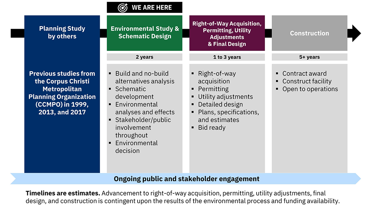
Project development process
TxDOT is currently in the Environmental Study and Schematic Design phase. It is expected to take approximately two years. See the Environmental Study page for more information.
During this phase, alternatives will be analyzed, schematic design will be developed, environmental effects will be determined, and continuous stakeholder and public involvement will be conducted. This effort will ultimately lead to an environmental decision.