US 281 at SH 71 Interchange
Introduction
TxDOT is proposing safety and mobility improvements at the US 281 and SH 71 interchange in Burnet County. The proposed project would construct a new interchange at US 281 at SH 71. Most of US 281 functions as a local thoroughfare, commuter highway and freight corridor. The Texas Freight Mobility Plan 2018 identifies US 281 as a key highway corridor being used by the agricultural industry in Texas. SH 71 is the main route from Austin into the Hill Country and towards the Highland Lakes region in Burnet County. This interchange is integral to the mobility of freight and commuters, and provides access to popular travel destinations in Central Texas.
Current conditions
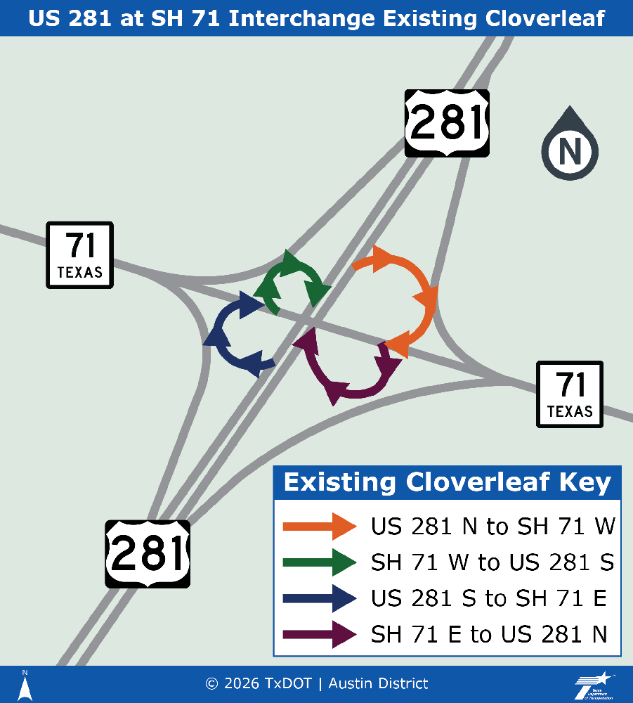
Currently, the US 281 at SH 71 interchange is a cloverleaf interchange. Around the interchange, US 281 is a four-lane arterial (two lanes in each direction) and each direction of traffic is separated with a grassy median. At the interchange and west of the interchange, SH 71 is an undivided 2-lane arterial (1 lane in each direction). East of the interchange, SH 71 is an undivided four-lane arterial (two lanes in each direction).
Project background
This project is needed because the US 281 and SH 71 interchange is inadequate to meet current and future traffic volumes, resulting in congestion and reduced mobility. It also lacks adequate bicycle and pedestrian accommodations/connectivity.
Proposed improvements
- Replacing the current cloverleaf interchange with a turbine interchange
- Adding elevated structures to improve mobility through the interchange
- Adding frontage roads to separate high-speed through traffic from local traffic
- Adding shared-use paths to accommodate bicyclists and pedestrians
Existing cloverleaf interchange
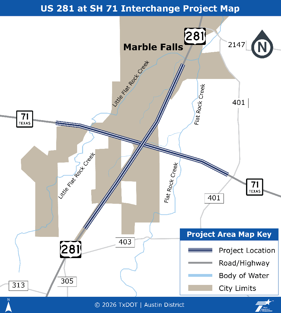
Project location
Additional information
The project requires approximately 96 acres of proposed right-of-way including permanent and temporary easements and one displacement of a single-family residential structure.
The estimated construction cost is approximately $243M.
Next steps
Next Steps (subject to change):
The schematic design and environmental study is anticipated to be complete in 2026.
- Public meeting - March 28, 2024
- Public hearing - April 9, 2026
- Environmental clearance – estimated fall 2026
- Construction – TBD
Get involved
Public engagement is an important element of this project. TxDOT encourages the public to be informed and engaged throughout the process.
When meetings are announced, they will be added to this page.