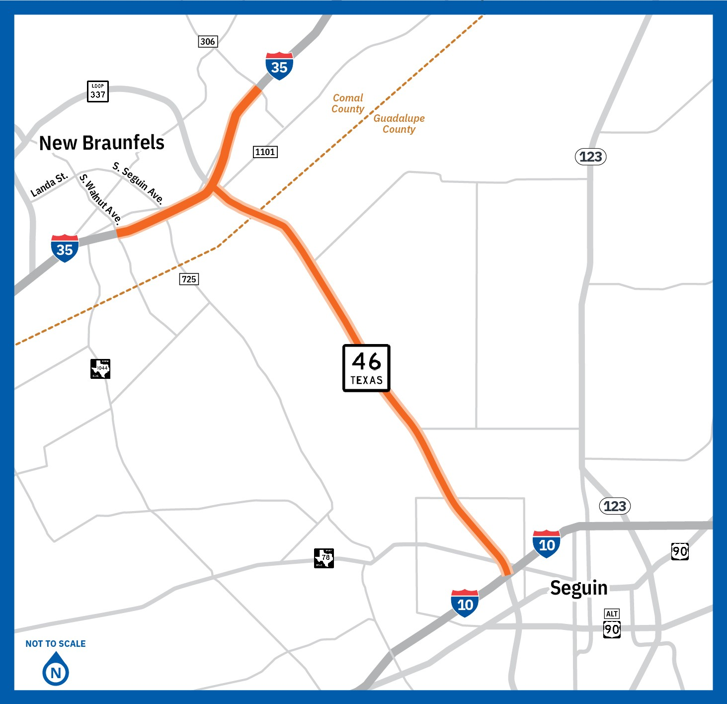
SH 46 from I-35 to I-10
Project background
The Texas Department of Transportation San Antonio District is proposing to improve SH 46 from I-35 to I-10 and I-35 from South Walnut Avenue to FM 306 in Comal and Guadalupe counties, Texas. TxDOT has been working collaboratively with Comal County, the City of New Braunfels, Guadalupe County and the City of Seguin to help identify corridor issues and concerns.
Project description
Improvements to SH 46 are necessary to accommodate current and projected future traffic volumes and support regional population growth. The purpose of the project is to reduce congestion, improve mobility and increase safety along SH 46. TxDOT is proposing to expand SH 46 through a series of operational and corridor upgrades including additional lanes, overpasses and intersection improvements. The proposed expansion also includes limited ramp reconstruction along I-35.
Project location map

Proposed improvements
COMAL COUNTY: Proposed SH 46 from I-35 to the Comal/Guadalupe County line
- Constructing new SH 46 mainlanes elevated over the existing at-grade SH 46 roadway.
- Constructing two direct connecting flyover ramps between SH 46 and I-35.
- Constructing new overpasses at:
- Elliot Knox Boulevard (Business 35)
- I-35
- FM 1101 (Freiheit Road)
- Alves Lane
GUADALUPE COUNTY: Proposed SH 46 from the Comal/Guadalupe County line to I-10
- Expanding SH 46 to a four-lane controlled access highway with two-lane, one-way frontage roads.
- Constructing overpasses at:
- Mary Boulevard/Saengerhalle Road
- Weltner Road
- Link Road
- Cordova Road/Three Oaks Road
- Rudeloff Road
- Hiddenbrooke Pass
- I-10
*Proposed improvements listed here are preliminary and subject to change.
Anticipated project schedule
The proposed project began in 2020. In 2021, TxDOT initiated coordination with the cities of Seguin and New Braunfels, as well as Comal and Guadalupe counties. Meetings with potentially affected property owners took place in 2022. In January 2023, TxDOT hosted a virtual public meeting, accompanied by in-person open houses in New Braunfels and Seguin.
Refinements to the draft schematic design are currently underway.
Next steps include additional public involvement opportunities, such as meetings with potentially affected property owners and an in-person meeting public hearing with virtual option.
Following those efforts, TxDOT will work to finalize the schematic design and environmental study documentation, followed by the potential environmental approval of the project. The timeline for these next steps is still to be determined.
Subsequent project development schedules for final design, right-of-way acquisition and construction will be dependent on environmental clearance and funding availability.
Project updates and public involvement
For project updates, please email your name and contact information to SH46_Study@pozcam.com. Please include “Updates on SH 46 from I-35 to I-10” in the subject line.
The purpose of public involvement is to share project information, provide updates, and gather public input. TxDOT is committed to working closely with the public throughout this process. Public input will help shape the proposed design as TxDOT works to enhance safety, improve mobility, and accommodate future growth along the corridor.