Brookshire-Pattison Mobility Study
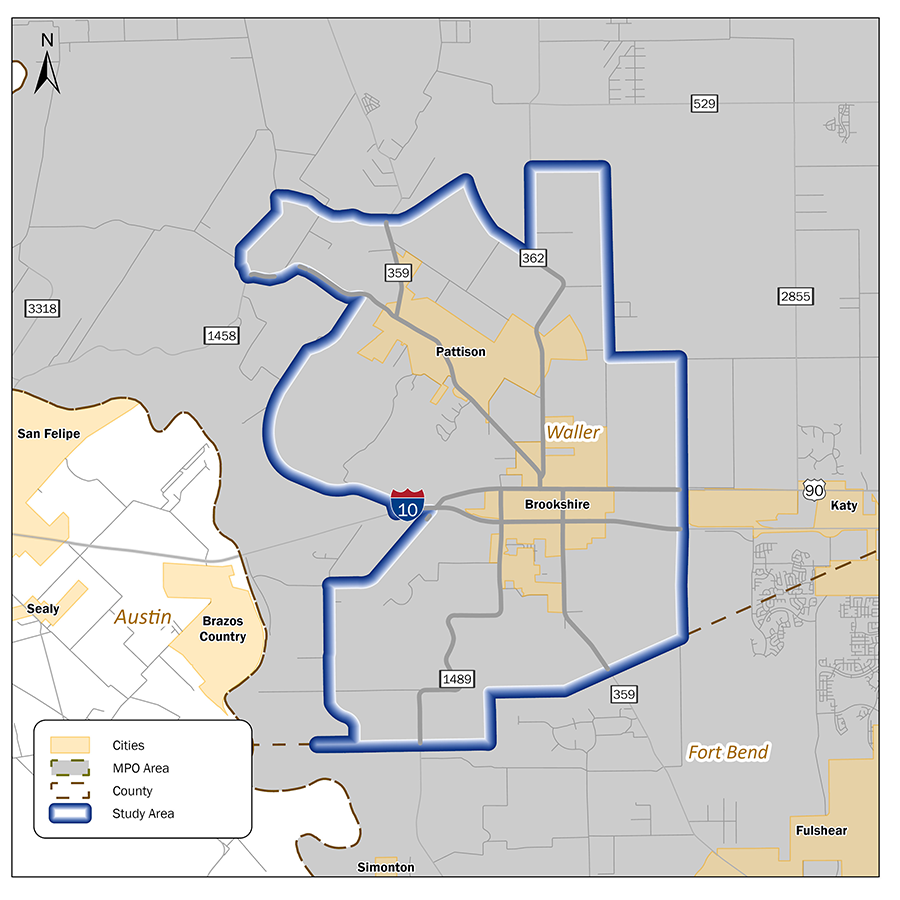
TxDOT is conducting a mobility study for the City of Brookshire, City of Pattison, and their surrounding areas as shown in the Study Area map. The study encompasses over 29 miles of roadway across the six key corridors within the study boundaries:
- North-South mobility: FM 359, FM 362, FM 1489
- East-West mobility: IH-10, US 90, FM 1458
In collaboration with local officials, key stakeholders and the general public, the study will provide a clear understanding of current transportation conditions, anticipated growth, and future mobility needs to support this fast-developing region.

Study purpose
The purpose of the study is to identify short–, medium-, and long-term transportation solutions that improve safety, mobility, and sustainability while accommodating the region’s residential and commercial growth.
Benefits
The study aims to:
- Promote multimodal passenger and freight mobility
- Improve safety through reduced crashes
- Improve mobility and congestion
- Prepare the infrastructure to accommodate the expected growth in the region
- Preserve and enhance economic opportunities along the corridor
Public involvement
TxDOT will implement its policy of robust and proactive community outreach. In this study TxDOT will provide complete and accurate information, timely public notice, access to key decisions, and opportunities for early and continuous involvement.
There are a number of ways the community can participate in the study. TxDOT aims to understand, from those who know the Brookshire-Pattison area best, what transportation related opportunities and challenges exist in the study area. This page will be updated with the latest information on the study’s progress and related public involvement events regularly.