
TxDOT drainage commitments: updated standards
The I-45 NHHIP incorporates the latest data from Atlas-14, a nationwide study that integrates additional historical rainfall data, including significant rainfall from Hurricane Harvey. This ensures a more accurate understanding of long-term rainfall patterns.
To maximize effectiveness, TxDOT’s drainage models for the NHHIP were developed in collaboration with the Harris County Flood Control District (HCFCD), meeting updated criteria to enhance stormwater resiliency.
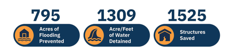
The I-45 North Houston Highway Improvement Project (NHHIP) incorporates advanced stormwater management systems capable of handling enough water to fill the Astrodome nearly 1.5 times. Drainage improvements are a core feature of TxDOT reconstruction projects, ensuring effective flood mitigation and stormwater control. ”
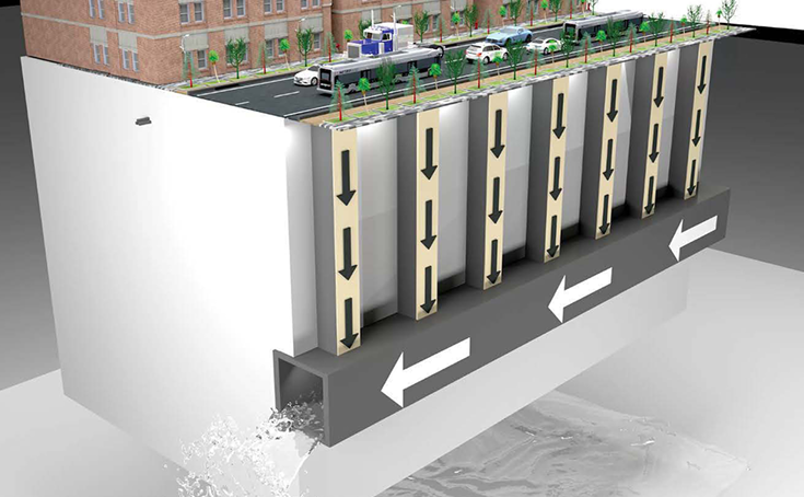
How the drainage process works
- Stormwater Collection: Rainwater flows into street drains designed to handle large volumes of stormwater.
-
Conveyance to Detention Ponds: Drains channel the stormwater to designated detention ponds, reducing immediate runoff.
-
Gradual Release: Detention ponds temporarily hold stormwater, releasing it slowly into nearby bayous to minimize flood risks.
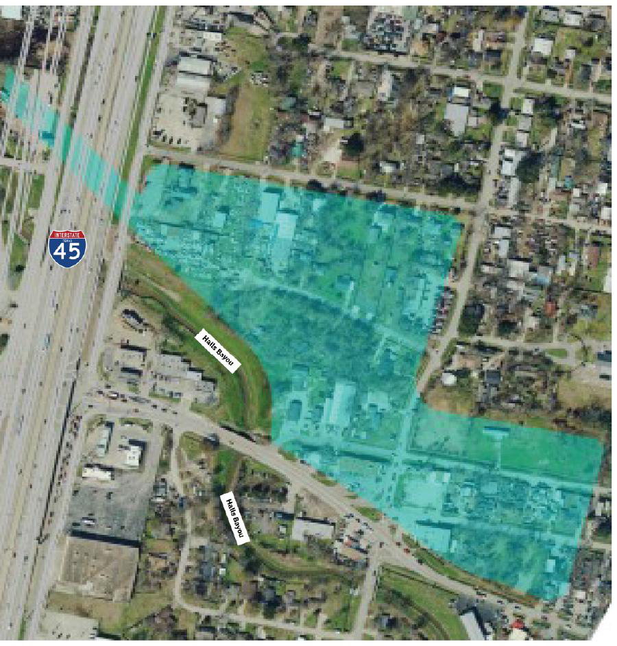
Detention ponds at Halls Bayou
To further enhance stormwater management and flood control, TxDOT is working with HCFCD to introduce new detention ponds at Halls Bayou near I-45. These ponds, shown in light blue in the image, will improve the region's stormwater storage capacity and resilience against flooding.
This comprehensive approach underscores TxDOT’s commitment to ensuring the I-45 NHHIP supports Houston’s long-term stormwater and flood mitigation goals.
Independence Heights: enhancing flood resilience
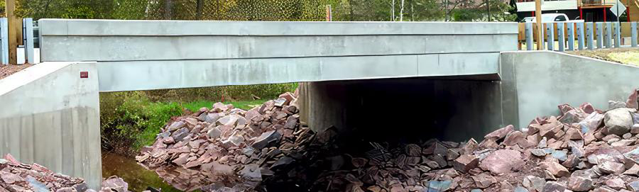
The I-45 North Houston Highway Improvement Project (NHHIP) includes significant drainage upgrades designed to protect the Independence Heights neighborhood. One key improvement is replacing concrete drain culverts with bridges, which will allow more stormwater to flow efficiently away from the area near I-45 and I-610.
Visualizing the impact
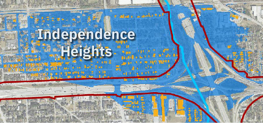
Current conditions
The map on the left highlights Independence Heights within the blue floodplain, indicating the community’s vulnerability to flooding.
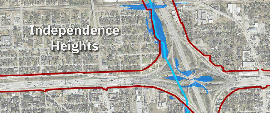
Projected improvements
The map on the right shows a significant reduction in the floodplain, with most of Independence Heights removed from the blue area after the drainage enhancements are implemented.
These improvements will enhance the community’s stormwater management capabilities, underscoring TxDOT’s commitment to reducing flood risks and improving the resilience of Independence Heights.