About
Key information
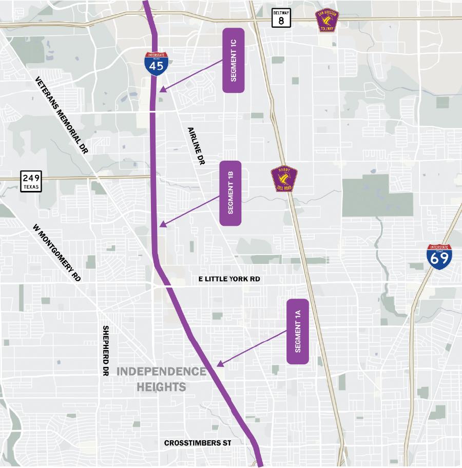
Segment 1 encompasses the stretch of I-45 from I-610 to Beltway 8. Planned improvements include upgrades to the mainlanes, frontage roads, drainage systems, and enhanced connectivity between I-45 and Beltway 8.
Due to pending funding, the final design for Segment 1 of the I-45 Project has not yet commenced. However, the basic improvements for this segment were approved with the Record of Decision (ROD) in 2021.The anticipated timeline to begin Segment 1 construction is 2032, though TxDOT may expedite the schedule as funding becomes available.The estimated construction cost for this portion of the project is $1.15 billion.
Construction phasing

Project funding

Total cost = $907,200,000
The segment 1 projects are unfunded and are not actively in detailed design.
The project brings significant economic impacts to the Houston area as well as much needed safety improvements to one of the state's most congested highways. Some 92,000 direct jobs are being created with an additional 89,000 indirect jobs generated from this project. The overall statewide economic impact of NHHIP is estimated at $19.2 billion.
The future of transportation is changing and the infrastructure in the nation's fourth largest city needs to change with it. Parts of the I-45 corridor have not changed since being constructed over 50 years ago. The I-45 improvement project not only brings these highways up to current standards, but also prepares for the future by improving resiliency to weather events and providing safer more efficient travel that could accommodate the transition to electric and self-driving vehicles. And, importantly, it will increase the opportunity for transit and high-occupancy vehicles as a mode choice for those traveling along the I-45 North Houston corridor. Additionally, the neighborhoods in the project area will see many specific benefits beyond the economic and safety improvements.
Segment 1 map
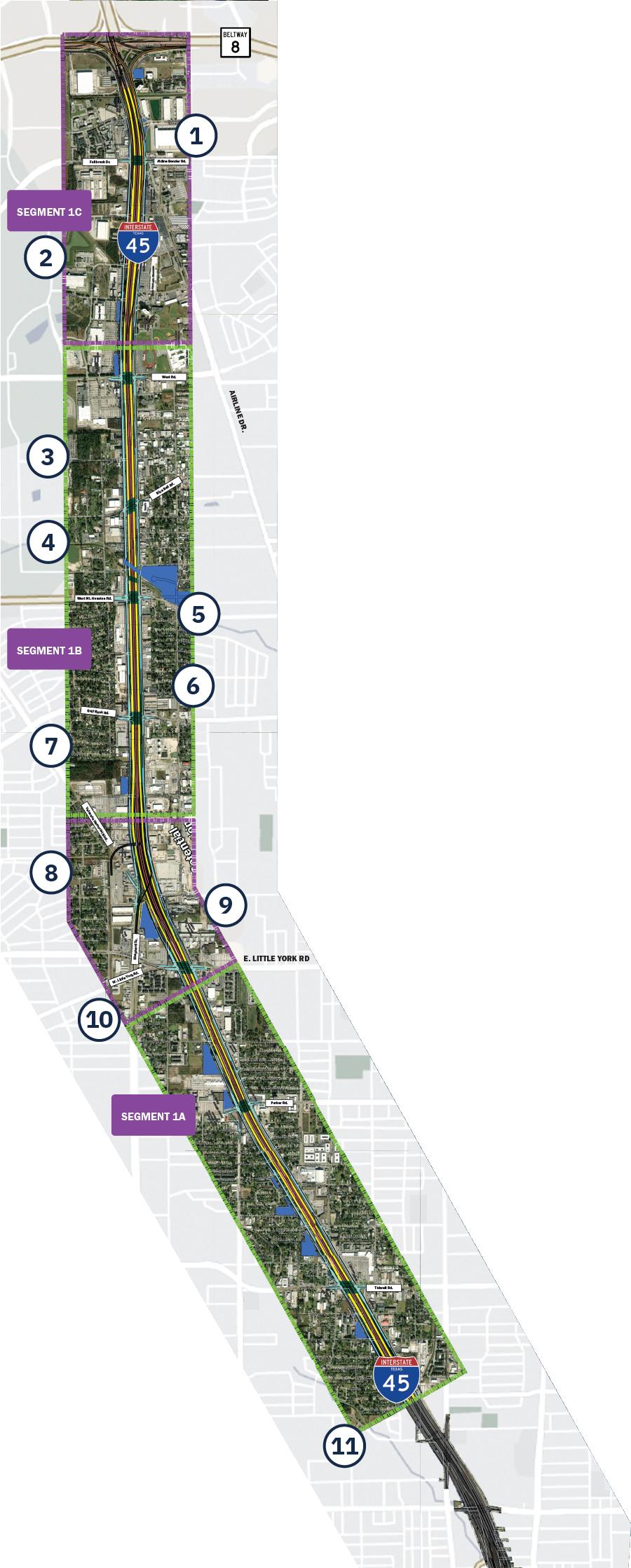
Segment 1 key features
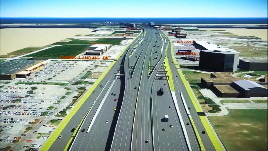
1. I-45 widening
The project expands I-45 to include four Managed Express (MaX) lanes, which are designed to enhance public transit options and improve overall traffic management.
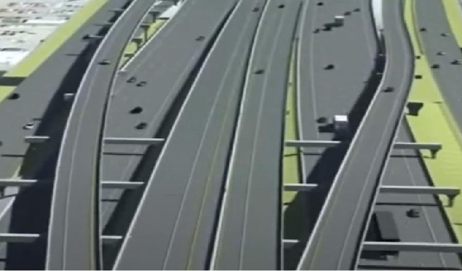
2. Lane connections:
New connections will seamlessly link the I-45 MaX lanes to Beltway 8, improving traffic flow and accessibility for drivers.
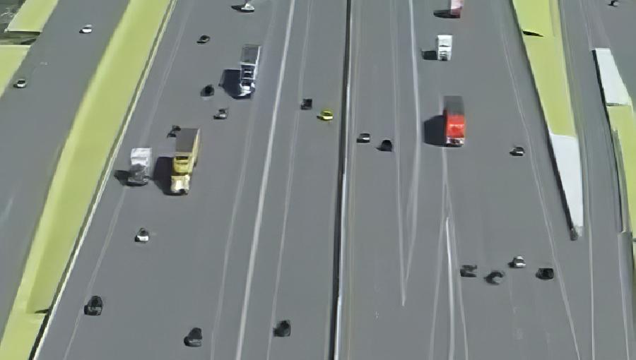
3. Exit and entrance ramps:
Direct ramps will provide easier access from the I-45 MaX lanes to the southbound frontage road and northbound exit near Aldine Bender and West Roads, streamlining local travel.
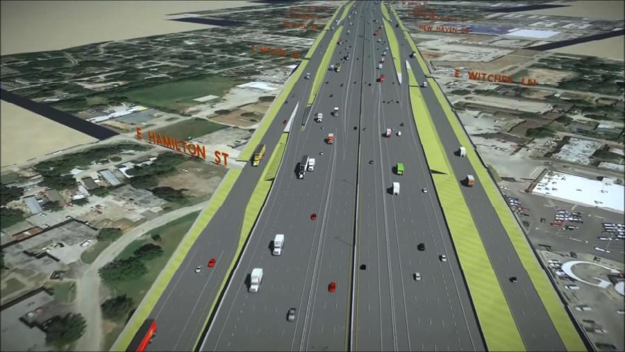
4. Access between general purpose and MaX lanes:
Drivers can easily transition between general-purpose lanes and MaX lanes at key points along the corridor, including areas near W. Mount Houston, West Roads, Tidwell, and Parker Roads.
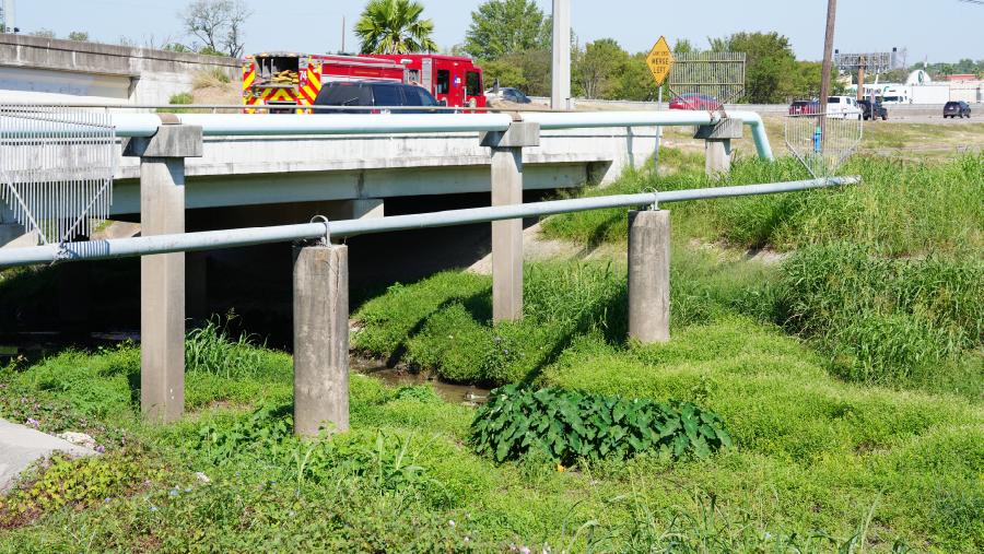
5. Halls Bayou bridge expansion:
Bridges over Halls Bayou will be widened to accommodate future channel improvements, supporting better flood control and infrastructure resilience.
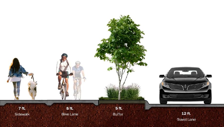
6. Bike and pedestrian paths:
Continuous bike and pedestrian paths will run along the corridor, with connections at intersections to improve access and connectivity for nearby communities.
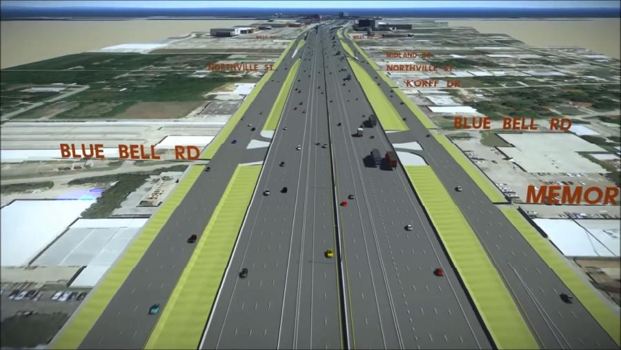
7. New overpass at Blue Bell Road:
A proposed overpass at Blue Bell Road will enhance traffic flow and community access, developed in partnership with the City of Houston under the Memorandum of Understanding (MOU).
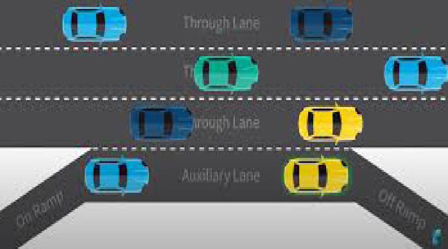
8. Auxiliary lanes:
New auxiliary lanes will be added between entrance and exit ramps at select locations to improve traffic flow and provide safer transitions for drivers.
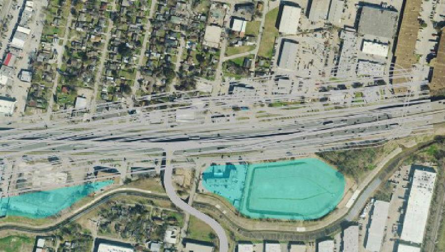
9. Detention ponds:
Multiple detention ponds, developed in partnership with the Harris County Flood Control District (HCFCD), will enhance flood resilience and manage stormwater effectively throughout the region.
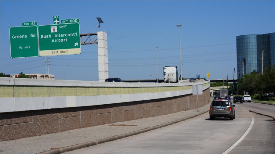
10. Lane and shoulder upgrades:
All lanes, shoulders, and interchange configurations will be updated to meet modern design and safety standards, improving traffic flow and ensuring safer conditions for drivers
Potential footprint reduction
TxDOT remains committed to evaluating reasonable opportunities to reduce the project footprint in Segment 1 in ways that would not compromise the Purpose and Need of the project, as described in the Record of Decision (ROD).
As noted in the VRA, TxDOT agrees that requests to reduce the Project footprint should be evaluated with a focus on the following:
- Strengthening Houston's economy.
- Reducing flooding on and off the freeway.
- Making travel safer for all road users.
- Providing long-term capacity for all users of the roadway, including automobile, freight, and transit.
- Serving and preserving the neighborhoods along the corridor while enhancing connectivity between neighborhoods.
- Mitigating impacts to existing parks and open space while creating additional opportunity for open space.
- Ensuring accessible evacuation routes.
TxDOT agrees to use the least amount of right-of-way as allowed and defined by law, after evaluation of the project footprint. It is important to note that any proposals to reduce the Project footprint must not compromise safety, flooding mitigation, design standards, freight mobility and evacuation effectiveness.
ROW reduction methodology & guidelines
- Meets Project Purpose and Need as stated in Record of Decision (ROD)
- No design exceptions
- No reduction in capacity
- Consider braided ramps where applicable
- Braided ramps are where the exit/entrance ramps are in the same space, with one over the other
- No elevated MaX lanes
- Minimum 20-foot border width on frontage roads
- All frontage roads to include bicycle/pedestrian facilities (no on-street bicycle facilities allowed)
- Potential sound wall locations
- Evaluate different ramp envelopes (this is the distance needed between the inside edge of frontage road and general purpose lanes for the ramps)
Drainage
- Detention Pond locations were revised based on updated Drainage Studies completed in 2021.
- Revised pond locations shown on Segment 1 plan view.
Proposed typical section

Design request & response
Request
- Reconnect Blue Bell Rd. across I-45.
- Avoid impacts to Unity Spirit Missionary Worship Center.
- For frontage roads in urban areas: focus on all road users with slow car speeds; use National Association of City Transportation Officials (NACTO) Urban Street Design Guide as a reference; and conform to City of Houston’s Infrastructure Design Manual and match the existing layout at both ends.
Response
- Reconnected Blue Bell Road across I-45 to allow for safer circulation from east to west side of I-45.
- Revised design to avoid Unity Spirit Missionary Worship Center.
- City streets that cross or connect to NHHIP will follow the City of Houston design standards and Context Sensitive guidelines. NACTO criteria was considered for this project, and as such, high comfort bicycle facilities (known as “pedestrian realms” for the NHHIP) are being implemented in the design where feasible. In addition, TxDOT coordinated with the COH regarding the specific design of the city street network adjacent to and crossing the NHHIP. TxDOT coordinated with the COH to incorporate the COH Bike Plan and desired bicycle/pedestrian accommodations on city streets. The intersection designs will be further refined during detailed design, in coordination with the COH.
Request
- All intersections should be designed for safe crossings and accessibility for pedestrians especially with regard to METRO bus stops.
- All lanes on city streets and frontage roads should comply with City of Houston’s 11’ lane standards. Multiple streets have been shown with sweeping, large radius turns; project should minimize these issues.
- Define which intersections are proposed with traffic signals and all-way stop control.
Response
- TxDOT coordinated with the COH regarding the specific design of the city street network adjacent to and crossing the NHHIP. TxDOT also coordinated with the COH to incorporate the COH Bike Plan and desired bicycle/pedestrian accommodations on city streets. The intersection designs will be further refined during detailed design, in coordination with the COH and METRO.
- Frontage road design will accommodate large radius turns and intersections will avoid pedestrian islands. The streets parallel to the freeway in Segments 2 and 3 will follow the City of Houston standards and lanes will be 11’ wide. The frontage roads in Segment 1 function as a transition between the freeway and the local businesses and need to retain TxDOT design standards of 12’ lanes.
- Frontage road intersection signalization will be determined during the final design phase.
Request
- Airline Drive, Victoria Drive and northbound I-45 intersection should operate safely for people traveling in any mode of transportation.
- Consider extension and direct connection from I-45 MaX lanes to Greens Road
Response
- TxDOT studied the Airline Drive/Victoria Drive/I-45 intersection, but due to the complexity and severe angle of the intersection, it could not be revised without major impacts to adjacent businesses. TxDOT’s focus when evaluating this intersection was to enhance safety, and maintain access. Sidewalk and bicycle facilities will be added to this intersection, and detailed during final design, along with the traffic signal design, to ensure safety for all modes of travel.
- Adding a connection from the I-45 MaX lanes and Greens Road is outside of the project limits for NHHIP, but will be considered under a separate ongoing project (I-45 N: North Houston to Conroe Study)
