About
Key information
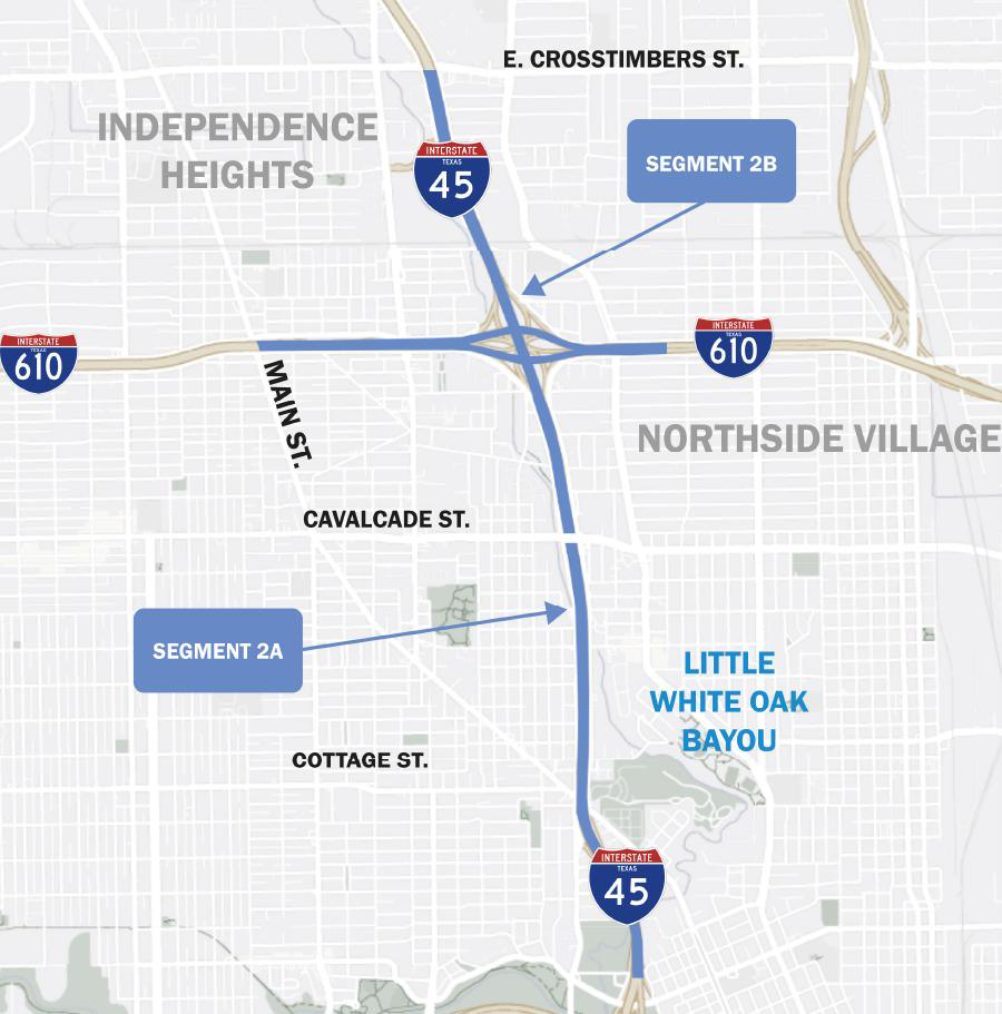
Segment 2 encompasses the stretch of I-45 from I-10 to I-610. Planned improvements include upgrades to the mainlanes, frontage roads, drainage systems, and rebuild of the I-45/I-610 interchange.
Due to pending funding, the final design for Segment 2 of the I-45 Project has not yet commenced. However, the basic improvements for this segment were approved with the Record of Decision (ROD) in 2021.
The anticipated timeline to begin Segment 2 construction is 2028, though TxDOT may expedite the schedule as funding becomes available.
The estimated construction cost for this portion of the project is $1.62 billion.
Construction phasing

Project funding

Total cost = $1,620,200,000
Segment 2 key features

1. I-45 widening
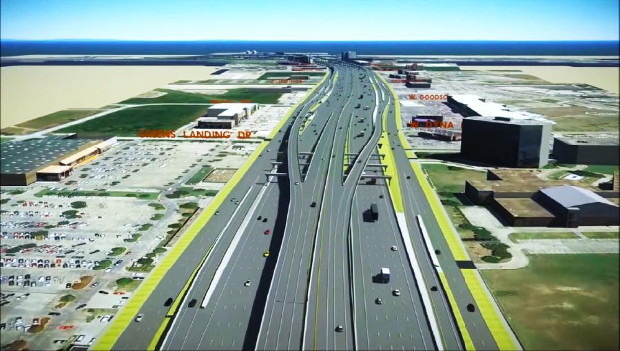
The segment will expand I-45 to include four Managed Express (MaX) lanes, promoting transit opportunities and improving traffic efficiency.
2. Potential roadway cap
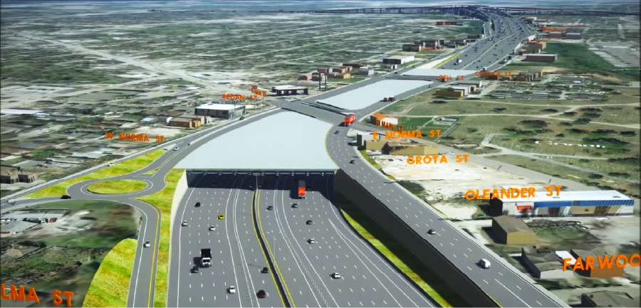
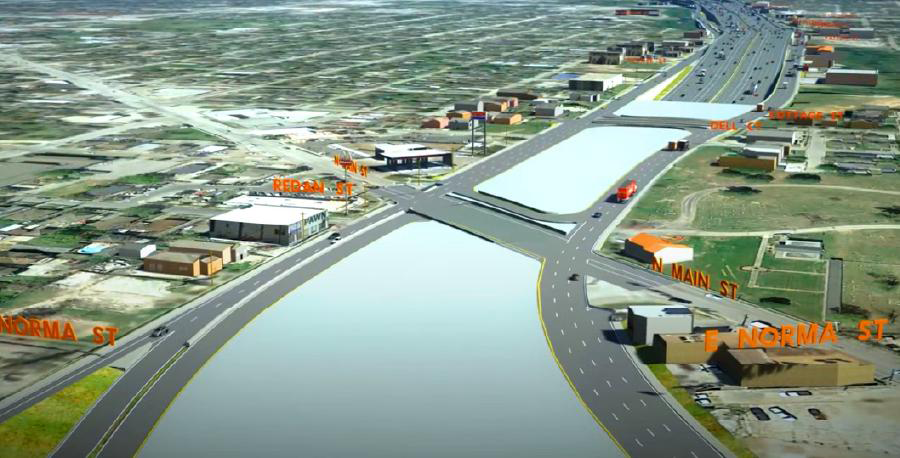
I-45 mainlanes will be lowered below ground level between Cottage and N. Main Streets, creating the potential for a structural cap. This cap could host community-focused amenities, to be developed and funded through partnerships with third parties.
3. Continuous frontage roads and ramp configurations
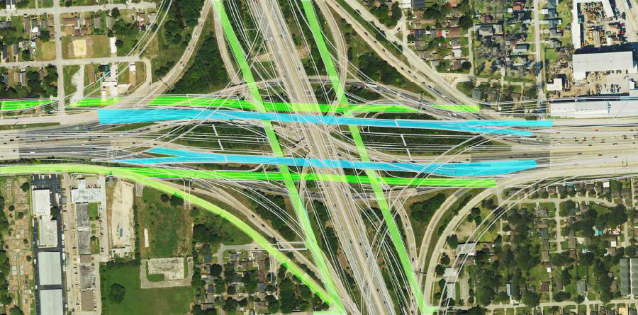
Continuous frontage roads will be constructed along I-45 northbound and southbound, as well as I-610 eastbound and westbound at the I-45/I-610 interchange. Ramp configurations at I-610 will also be revised to enhance traffic flow and improve driver safety.
4. Minimized right of way (ROW):
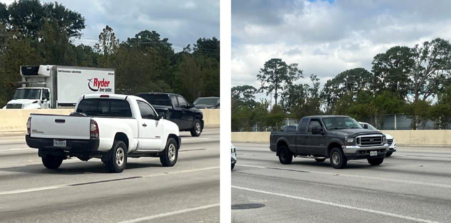
By reducing the design speed south of N. Main Street to 50 MPH, the need for additional ROW is minimized, reducing the project’s overall footprint.
5. Preserved right of way:

The southbound I-45 frontage road will be partially constructed over the southbound mainlanes to conserve ROW and avoid impacts to the adjacent Hollywood Cemetery.
6. Improved drainage:
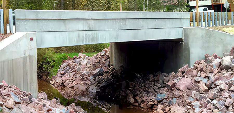
Existing culverts will be replaced with bridges, providing greater capacity for stormwater flow and improving flood management and resilience.
7. Detention ponds:
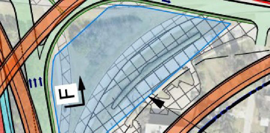
New detention ponds will be added, and existing approved ponds will be expanded, enhancing stormwater management and flood mitigation throughout the corridor.
Art of the possible: structural caps
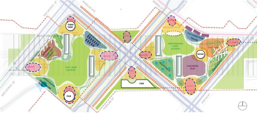
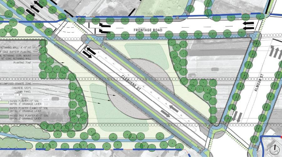
As part of the I-45 project, the mainlanes would be lowered below street level between N. Main Street and Cottage Street. This creates the potential for a structural cap—concrete infrastructure that allows a roadway to be built at natural ground level over the below-grade highway. ”
What is a cap?
A structural cap serves as the foundation for reimagining space above a lowered roadway. Beyond its engineering function, it presents a canvas for the "Art of the Possible," offering opportunities to repurpose the space into community-focused amenities such as parks, plazas, or other iconic destinations.

Potential footprint reduction
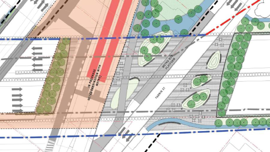
TxDOT remains committed to evaluating reasonable opportunities to reduce the project footprint in ways that would not compromise the Purpose and Need of the project, as described in the Record of Decision (ROD). In Segment 2, TxDOT is evaluating whether the project footprint can be reduced along I-45 northbound between North St. and North Main St. as shown in the image to the left.
ROW reduction methodology & guidelines
- Meets Project Purpose and Need as stated in Record of Decision (ROD)
- No design exceptions
- No reduction in capacity
- Consider braided ramps where applicable
- Braided ramps are where the exit/entrance ramps are in the same space, with one over the other
- No elevated MaX lanes
- Minimum 20-foot border width on frontage roads
- All frontage roads to include bicycle/pedestrian facilities (no on-street bicycle facilities allowed)
- Potential sound wall locations
- Evaluate different ramp widths to reduce right of way widths
Segment improvements
Independence Heights
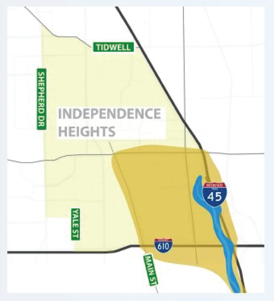
- Dark yellow area on map shows where Independence Heights has routinely flooded
- I-45 NHHIP proposes to replace drainage culverts with bridges, providing drainage improvements
- This area would be removed from the floodplain
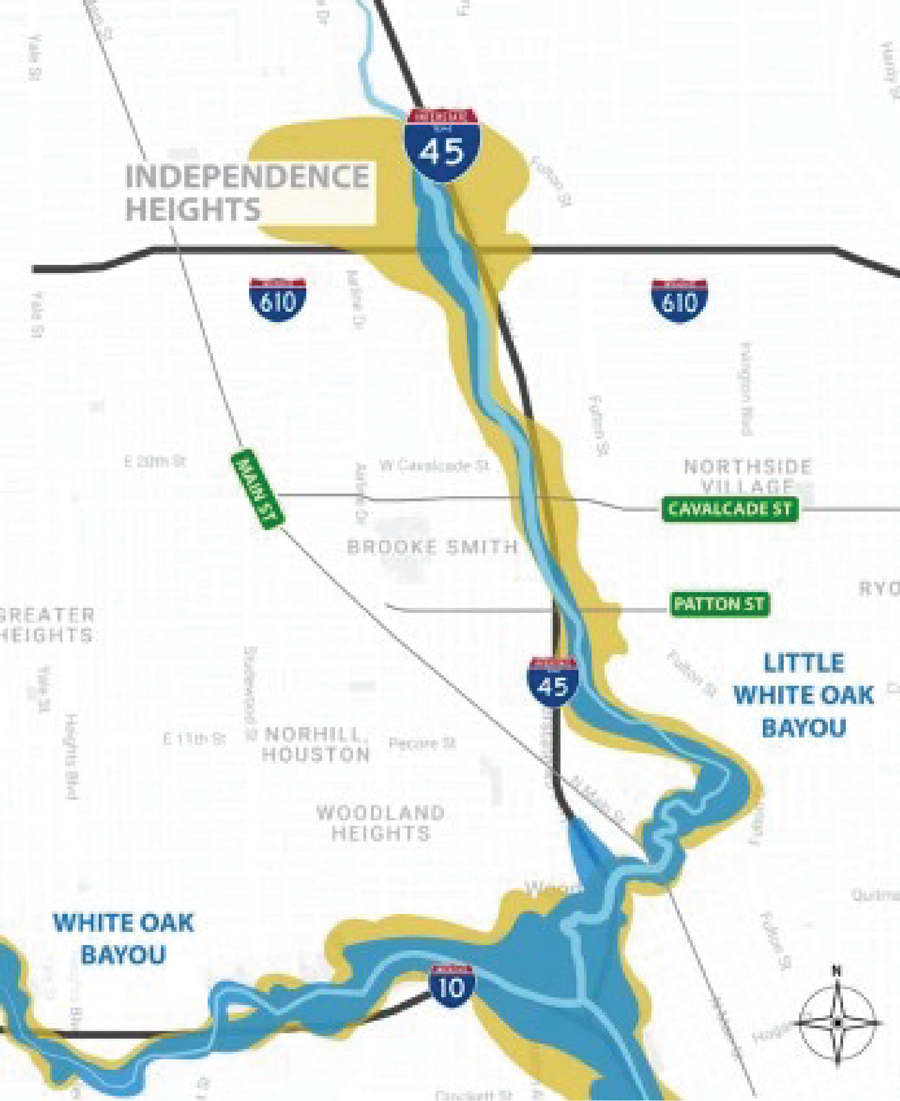
Drainage improvements
- 14 additional detention ponds, 42% greater capacity than required
- Increase in underground pipe capacity to take floodwater to detention ponds and pump stations
- Improvements along White Oak Bayou and Little White Oak Bayou will remove flooding from yellow area on map
