About
General overview
Segment 3 of the I-45 North Houston Highway Improvement Project (NHHIP) will transform the downtown Houston loop system. Key changes include:
-
Rerouting I-45: I-45 will be aligned parallel to I-10 on the north side of downtown and parallel to US 59/I-69 on the east side.
-
Downtown Connectors: A new system of entrance and exit ramps will connect I-45 to various downtown streets, improving access to the west side of downtown.
-
Pierce Elevated Removal: The existing elevated I-45 along the west and south sides of downtown will no longer serve a transportation function and could be removed.
-
Improved Geometry: Portions of I-10 and US 59/I-69 will be straightened to eliminate curves, enhancing safety and traffic flow.
Beyond mobility, Segment 3 will deliver flood mitigation through advanced drainage systems, improved connectivity, and opportunities for green space and beautification around downtown Houston.
Segment 3 status
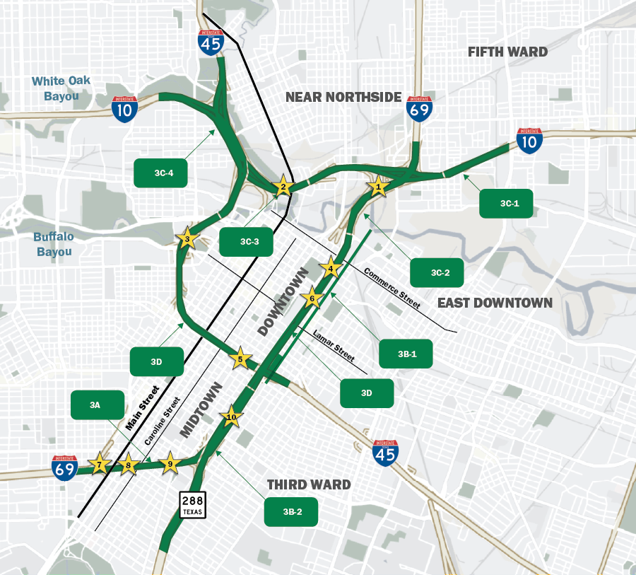
Segment 3 encompasses reconstruction of portions of I-10, I-45, I-69, and SH 288 around downtown Houston.
- Segment 3B-1 is the drainage improvement project along St. Emanuel Street in East Downtown. Construction began in October 2024.
- Segment 3B-2 is the project to rebuild the I-69 mainlanes from State Highway (SH) 288 to I-45, including the I-69/SH 288 interchange. Construction begin in January 2025.
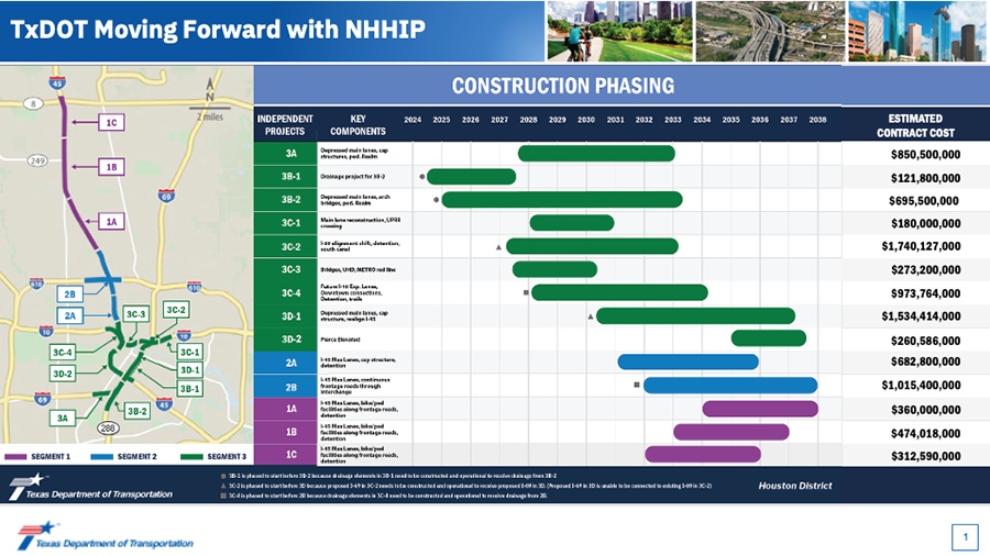
Construction phasing and funding
Segment 3 history
- The NHHIP Segment 3 project will ultimately reconstruct portions of I-10, I-45, I-69, and SH 288 around downtown Houston
- Segment 3, excluding 3A, was originally planned to be Design-Build (DB). Now, Segment 3B, 3A, and various other portions of Segment 3 will be constructed as traditional Design-Bid-Build (DBB) projects, in which design plans are developed prior to construction contractors providing bids.
- TxDOT studied elevated lanes, depressed lanes, underground tunnels, and combinations of all three. The only alternative that had a significant and positive impact was to depress US 59/ I-69 between Commerce St and Spur 527, and shift I-45 from the current alignment along Pierce Elevated and make it parallel with I-10 on the north side of Downtown and US 59/I-69 on the west side of Downtown.
Key features of segment 3
-
Widened I-69: Lanes will increase from 8 to 10 or 12 in each direction to accommodate traffic demands.
-
Express Lanes: Two new express lanes in each direction will facilitate through-traffic downtown.
-
Pierce Elevated Replacement: A Downtown Connector will replace the existing elevated structure, streamlining traffic flow.
-
Downtown and East Downtown Connection: A new southbound street will be constructed between Commerce Street and Leeland Street to improve connectivity.
-
Structural Cap Opportunity: A cap over the depressed section of I-69 from Lamar Street to Commerce Street, adjacent to the George R. Brown Convention Center, could host community amenities if developed by third parties.
This update highlights TxDOT's commitment to modernizing Houston's transportation infrastructure while enhancing connectivity, safety, and community spaces.
Pierce elevated transformation
The Pierce Elevated structure will no longer serve a transportation function and could be removed or repurposed, opening opportunities for innovative urban uses.

Structural caps: opportunities for community development
I-69 caps:
-
METRO LRT to Fannin Street: A cap could be constructed over the below-street-level section of I-69, creating potential for new amenities or green spaces to be developed by third parties.
-
Main Street to Caroline Street: Similar opportunities exist for a cap in this section, providing a platform for community-enhancing features.
-
Almeda Road to Cleburne Street: A structural cap in this area could integrate with planned street extensions, offering potential for small cap spaces on either side of Cleburne Street.
George R. Brown Convention Center cap:
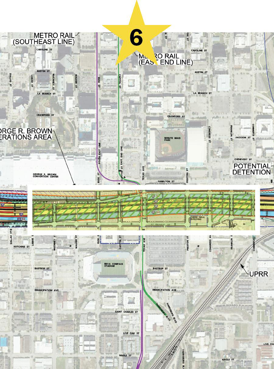
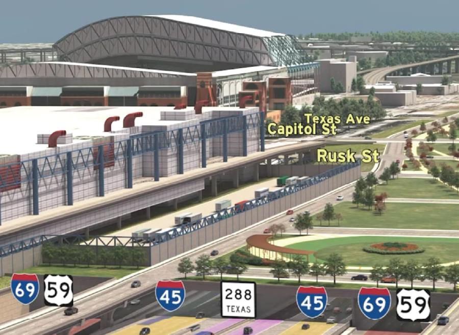
Lowering the freeway near the George R. Brown Convention Center would streamline traffic flow by separating Downtown-bound traffic from through traffic. This adjustment also introduces a cap concept, creating opportunities for significant community amenities above the freeway.
Wheeler Transit Center/Fannin Street cap:
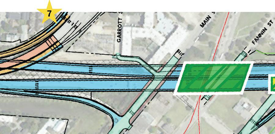
Coordination between TxDOT, the City of Houston, and METRO is underway to evaluate extending a cap over I-69 at the METRO Red Line near Fannin Street. This cap could host future amenities, fostering transit-oriented development.
Almeda Road/Cleburne Street cap:
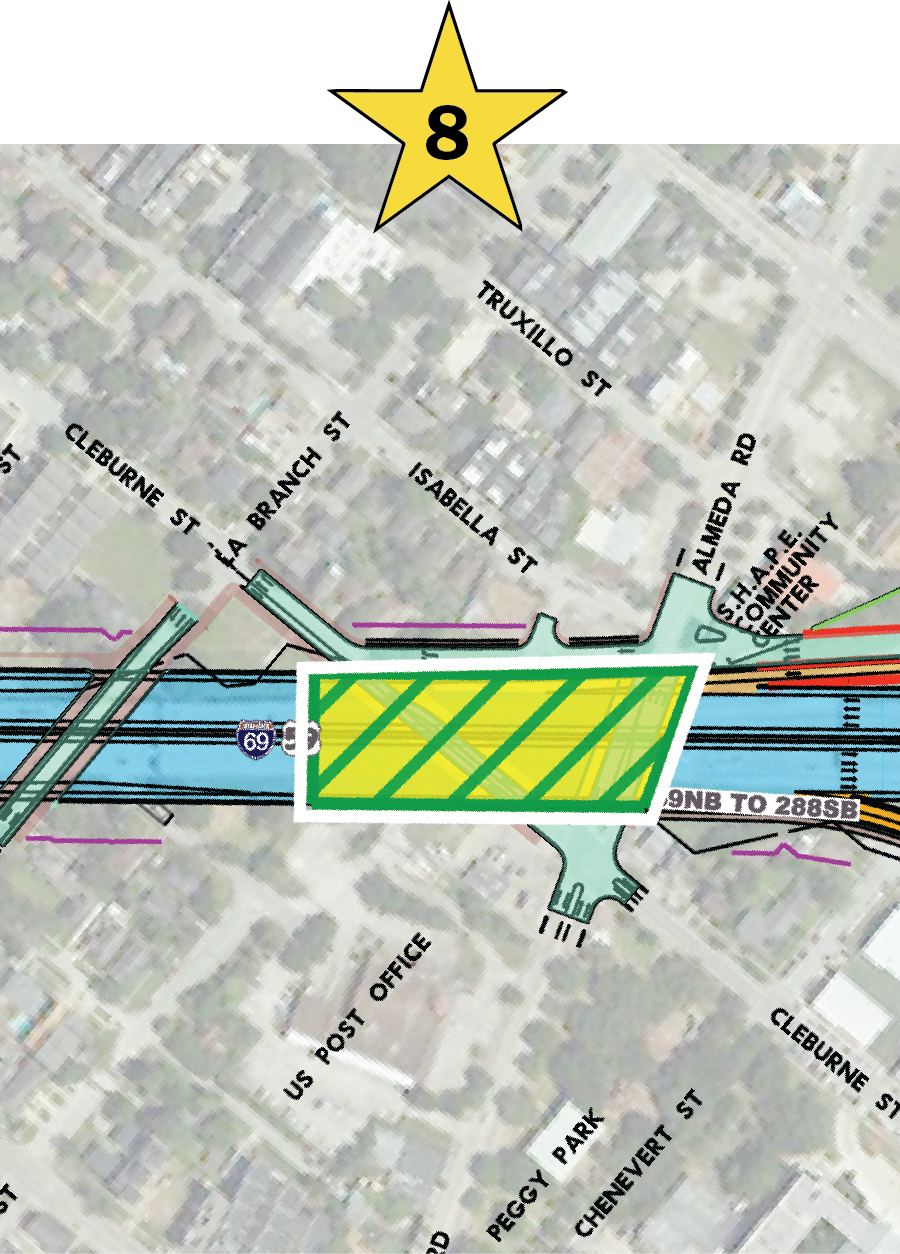
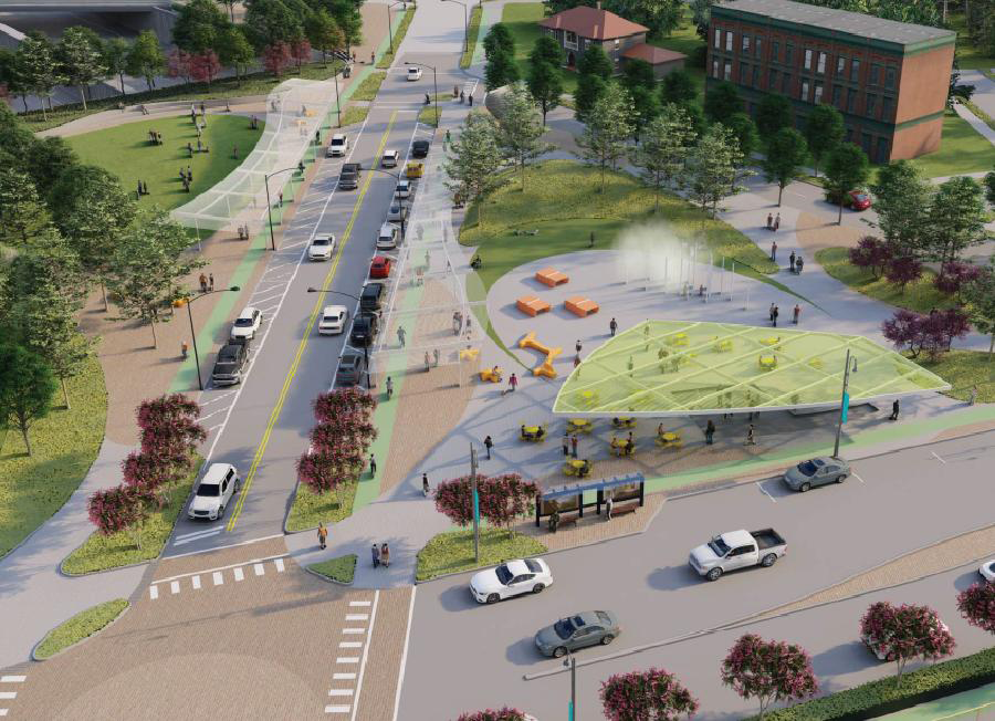
The planned extension of Cleburne Street across I-69 provides an opportunity for a small cap area. TxDOT is working with local organizations such as the OST/Almeda Corridors Redevelopment Authority, TIRZ #7, and the Greater Southeast Management District to support this potential cap and assess development opportunities.
Reconfigured arch bridges
Elgin Road/Tuam Street/McGowen Street:
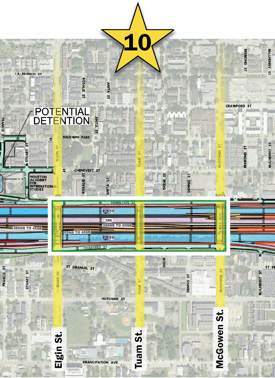
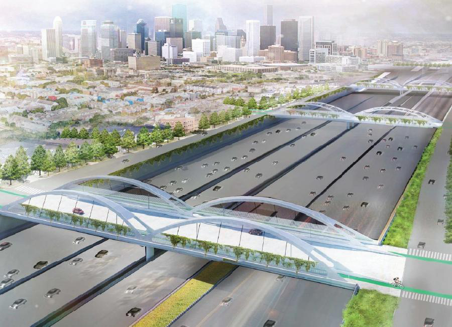
The redesign of cross streets at Elgin, Tuam, and McGowen includes the construction of arch bridges, ensuring safe passage over the freeway and reconnecting urban core communities. These bridges provide enhanced connectivity and strengthen ties between neighborhoods previously divided by the highway.
These caps and bridge enhancements reflect TxDOT’s commitment to integrating infrastructure improvements with opportunities for urban revitalization and community engagement.
Wheeler Transit Center/Fannin Street cap:
Segment 3C3 proposed changes
FEIS approved
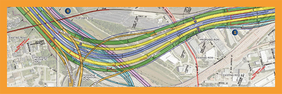
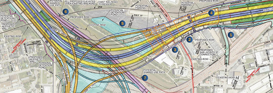
Proposed changes*
Segment 3C2 proposed changes
FEIS approved
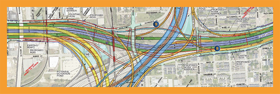
Proposed changes*

- Extend North San Jacinto St. to connect with Naylor and Providence streets along the new I-10 alignment.
- Response to community request
- Response to community request
- Make Naylor St. into a two-way from North Main St. to North San Jacinto St., and tie Naylor St. in with Providence St.
- Extend Naylor St. west of North Main St. so it ties into the University of Houston-Downtown (UHD) parking.
- Provide parking opportunities under roadway bridges to mitigate impacts to UHD parking.
- Build a new detention pond.
- All roadways in the area will pass over existing railroad tracks to avoid raising and realigning tracks.
- In coordination with Union Pacific Railroad
- In coordination with Union Pacific Railroad
- Add shared use path added along west side of White Oak Bayou.
- Build I-10 eastbound exit to Gregg St. under the I-69 northbound to I-10 eastbound direct connector.
- Response to community request
- Response to community request
- Extend I-10 westbound frontage road from Meadow St. to Jensen Dr.
- Response to community request
- Response to community request
- Build connection from Nance St. east to Rothwell St., providing access to Jensen Dr.
- Response to community request
Segment 3C and 3D proposed footprint reduction areas*
I-10 eastbound frontage road

These proposed design changes would eliminate or reduce the roadway footprint along I-10 eastbound frontage road west of I-69, and west of Downtown near one set of the proposed downtown connectors.
Downtown connectors at Walker Street
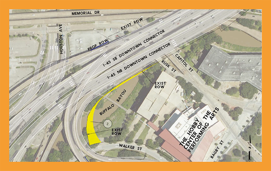
TxDOT continues to look for opportunities to reduce the footprint as final design progresses.
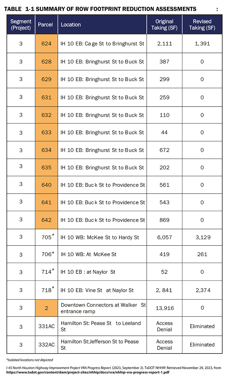
* NEPA reevaluations will be performed as needed when proposed changes deviate from the FEIS
Drainage
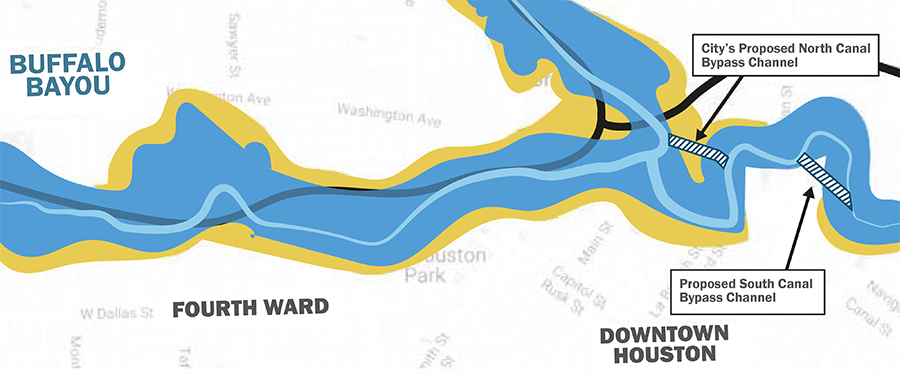
Buffalo Bayou
- TxDOT is providing $20M of funding in support of the City of Houston North Canal Project that reduces flooding risk
- South Canal to be built in the NHHIP
- Area shown in yellow is anticipated to no longer flood in a 100-year flood event
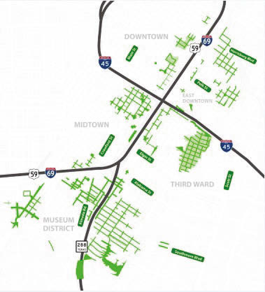
Ponding
- Green areas shown are anticipated to experience less ponding during rain events
